BLUF Executive Summary
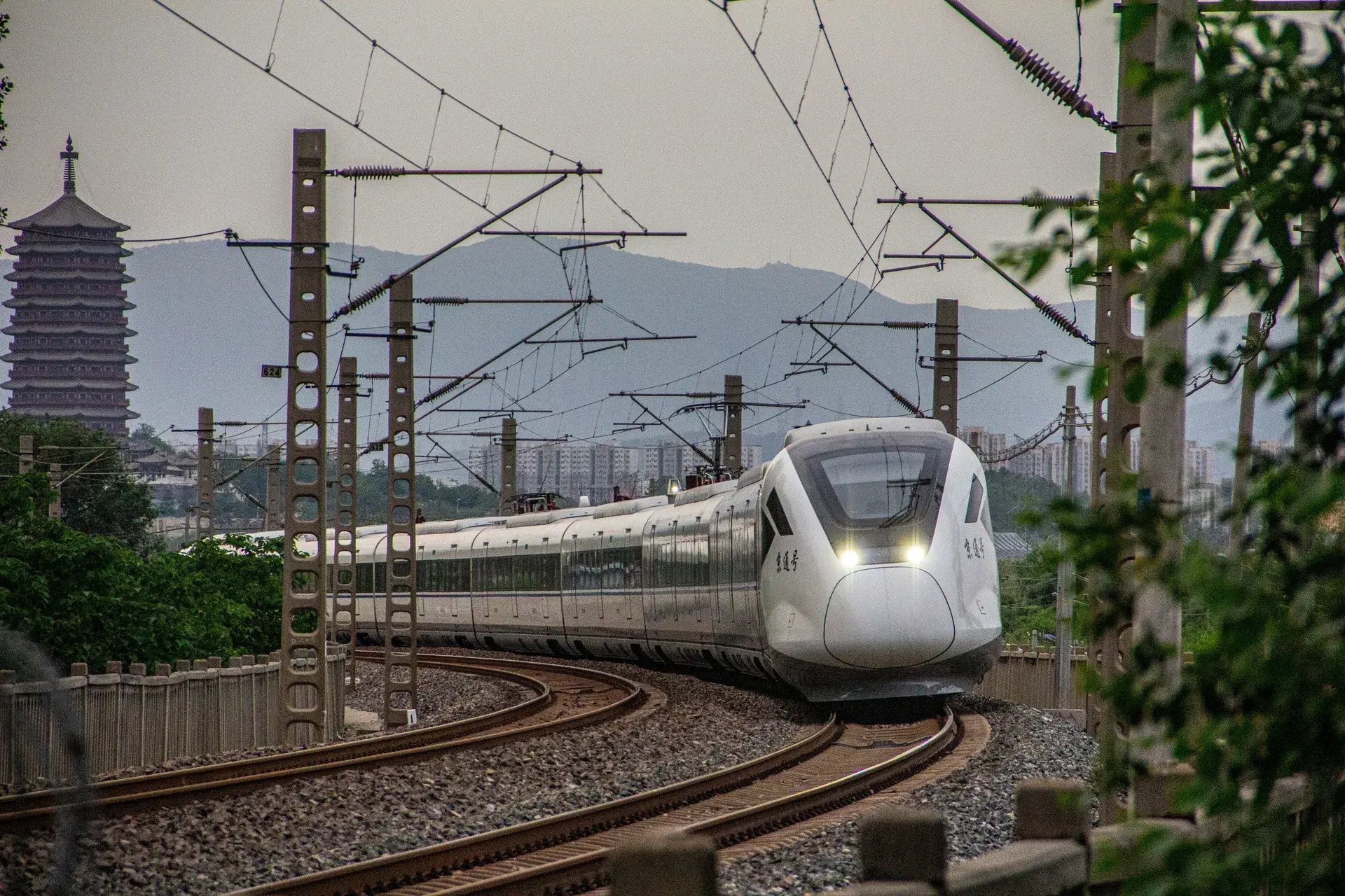
International wilderness travelers and high-net-worth clients planning bespoke alpine expeditions to Mount Siguniang (四姑娘山 / Sìgūniáng Shān) in Western Sichuan during peak summer months (Q3: July–September) must fundamentally recalibrate itinerary design to account for a permanent infrastructure disruption. Discussions on high-altitude travel forums (such as r/fatFIRE, r/Mountaineering, and r/ChinaTravel) increasingly document the operational impact of the Dujiangyan-Siguniangshan Mountain Railway (都四山地轨道交通, Dū Sì Shāndì Guǐdào Jiāotōng)—China's first alpine rack railway system, which entered operation in 2024. While the railway dramatically reduces transit time from the Chengdu Plain to Siguniangshan Town from a grueling 4–5 hour mountain road drive to a 2-hour oxygen-supplemented cabin journey, it introduces a permanent mass-tourism dilution effect across all front-valley scenic areas (Shuangqiaogou / 双桥沟, Changpinggou / 长坪沟, and Haizigou / 海子沟). For clients seeking exclusive, off-grid alpine wilderness, the only operationally valid strategy is a terminal-station physical segregation protocol combined with deep-backcountry extraction routing, executed immediately upon arrival.
The Investigative Hook & Background
Mount Siguniang's four glacier-clad summits—Dafeng (大峰, 5,025m), Erfeng (二峰, 5,276m), Sanfeng (三峰, 5,355m), and Yaomei (幺妹峰, 6,250m)—form one of the most technically demanding and visually spectacular alpine environments in continental Asia. For over three decades, the region's extreme physical isolation acted as a natural quality filter. The only gateway, the G350 National Highway over Balang Mountain Pass (巴朗山口, 4,500m), required 4–5 hours of winding mountain driving from Chengdu via Dujiangyan, discouraging casual day-trippers. This natural barrier preserved a near-exclusive wilderness atmosphere that attracted serious mountaineers, high-altitude trekkers, and discerning overland travelers.
The commissioning of the Dujiangyan-Siguniangshan Mountain Railway permanently dismantled this natural filter. China's railway engineering teams overcame the Hengduan Mountain topography—characterized by extreme vertical relief, active seismic zones, and sub-zero tunnel microclimates—by deploying a hybrid rack-and-adhesion railway system. The line burrows through 22 tunnels covering over 70% of the total route length, eliminates the hazardous Balang Mountain Pass section entirely, and delivers passengers at Siguniangshan Town (日隆, Rìlóng) in a climate-controlled, oxygen-enriched cabin environment. Daily passenger capacity expanded from a road-limited ceiling of approximately 5,000–8,000 vehicles per day to a railway-enabled throughput that can sustain over 15,000+ tourist movements per day at full operational capacity. The wilderness atmosphere of the front valleys has been permanently altered. The expedition design imperative has shifted decisively: the railway is a transit vector, not a destination; the real expedition begins the moment you exit the terminal station.
1. Technical Specifications of the Dujiangyan-Siguniangshan Mountain Railway
Understanding the engineering parameters of the railway is critical for accurate expedition planning and client briefings:
| Technical Parameter | Specification |
|---|---|
| Chinese Name | 都四山地轨道交通 (Dū Sì Shāndì Guǐdào Jiāotōng) |
| Route Corridor | Dujiangyan (都江堰) ➔ Siguniangshan Town (四姑娘山镇 / 日隆) |
| Total Length | ~140 km (full route, multi-phase) |
| Journey Time (End-to-End) | ~2 Hours (Express; includes oxygen-supplemented cabin) |
| Railway Type | Hybrid Rack-and-Adhesion Mountain Railway (齿轨铁路) |
| Tunnel Proportion | >70% of route in tunnels (22 major tunnel sections) |
| Elevation Change | Chengdu Plain (450m) ➔ Siguniangshan Town (3,180m) |
| Altitude Gain Bypassed | Eliminates Balang Mountain Pass crossing (4,500m) |
| Cabin Environment | Sealed, oxygen-supplemented pressurized cabins |
| Terminal Station | Siguniangshan Town (Rilong), direct access to front-valley scenic areas |
| Operational Status | Revenue operations commenced 2024 (Phase 1) |
Key Operational Insight for CAE Expedition Designers: The railway does not reach any climbing base camp. All technical alpinism—Dafeng (5,025m), Erfeng (5,276m), Sanfeng (5,355m), or Yaomei (6,250m)—still requires multi-day wilderness approach treks from Siguniangshan Town on foot, with pack horse support, gaining 1,500–3,000+ meters of altitude beyond the terminal.
2. Deconstructing the Front-Valley Dilution Effect
Understanding how the railway structurally alters visitor density patterns in Mount Siguniang's three main valleys:
  CHENGDU PLAIN (450m) ➔ DUJIANGYAN-SIGUNIANGSHAN RACK RAILWAY (2 Hours, O₂-Supplemented)
                                          │
                                          ▼
                         TERMINAL STATION: SIGUNIANGSHAN TOWN (3,180m / Rilong)
                                          │
                      ┌───────────────────┼───────────────────┐
                      ▼                   ▼                   ▼
          SHUANGQIAOGOU             CHANGPINGGOU           HAIZIGOU
          (双桥沟, ~3,200m)         (长坪沟, ~3,200m)      (海子沟, ~3,400m)
          • 40km electric bus        • 18km pack horse      • 15km trekking
          • 🚨 HIGH crowd density     • ⚠️ MODERATE density   • ⚠️ MODERATE density
          • Public boardwalk tour     • Scenic forest trail   • Alpine lake circuit
                      │                   │                   │
                      └───────────────────┴───────────────────┘
                                          │
                                          ▼
          CAE DEEP-BACKCOUNTRY EXTRACTION PROTOCOL (Pre-Arranged Private 4WD)
          • Dacaogou 大草沟 (Unmapped high pasture valley, 0 boardwalk infrastructure)
          • Zhagunao 扎根村 (Remote Tibetan high-pasture wilderness, 3,600m–4,200m)
          • Western Slopes Traversal (Gongga West Slope / Dangling Corridor)
          • Cross-Range Overland Extraction (Danba ➔ Xinduqiao ➔ Litang Deep Route)
          ✅ 100% OFF-GRID | 0 SHARED INFRASTRUCTURE | ZERO MASS-TOURIST CONTACT
| Metric | Pre-Railway Era (Road-Only Access) | Post-Railway Era (2024 Onwards) |
|---|---|---|
| Daily Visitor Throughput | ~5,000–8,000 (road-limited ceiling) | 🚨 15,000+ at peak capacity |
| Front-Valley Crowd Density | Moderate (seasonal peaks only) | 🚨 Year-round high density |
| Primary Tourist Profile | Serious trekkers, mountaineers | Mass domestic tourism + Day-trippers |
| Shuangqiaogou Character | Scenic low-density valley trekking | 🚨 Electric bus convoy + Boardwalk tourists |
| Changpinggou Character | Pack horse trail, moderate solitude | ⚠️ Weekend crowd surge now likely |
| Off-Grid Alpine Character | Preserved in front valleys (moderate) | ❌ Front valleys: commercially saturated |
| Off-Grid Character Available | Secondary valleys & deep backcountry | ✅ Deep backcountry: still fully pristine |
| Transit Time from Chengdu | 4–5 hrs (mountain road, Balang Pass) | ✅ ~2 hrs (rack railway, O₂ cabin) |
| High-Altitude Fatigue on Arrival | High (Balang Pass mountain road sickness) | ✅ Low (pressurized cabin comfort) |
Critical Reframe: The railway simultaneously delivers two contradictory outcomes for expedition travelers—it reduces physical transit fatigue while destroying front-valley wilderness quality. CAE's expedition design extracts maximum value from both realities: use the railway for physical comfort on transit, then immediately execute deep-backcountry extraction protocols to recover the wilderness atmosphere the railway has removed from front valleys.
3. Mount Siguniang Geographic & Climatic Intelligence Briefing
A rigorous understanding of the geography protects expedition itinerary integrity across all Q3 routing decisions.
3.1 The Four Peaks: Summit Architecture & Access Logic
Mount Siguniang (四姑娘山) consists of four summits arranged in a north-south ridge system within the Qionglai Mountain Range (邛崃山脉), a sub-range of the Hengduan Mountains (横断山脉). This ridge sits at the eastern edge of the Qinghai-Tibet Plateau transition zone:
| Peak | Chinese Name | Elevation | Technical Grade | Access Corridor | Permit Requirement |
|---|---|---|---|---|---|
| Dafeng (Big Peak) | 大峰 | 5,025m / 16,486ft | Alpine F-PD (non-technical) | Changpinggou Valley | SMA Permit |
| Erfeng (Second Peak) | 二峰 | 5,276m / 17,310ft | Alpine PD-AD | Changpinggou Valley | SMA + Team Permit |
| Sanfeng (Third Peak) | 三峰 | 5,355m / 17,569ft | Alpine AD-D (technical) | Changpinggou Valley | SMA + Guide Mandatory |
| Yaomei (Youngest Sister) | 幺妹峰 | 6,250m / 20,505ft | Alpine D-TD (expedition-grade) | Changpinggou / Special Permit | SMA + Expedition Permit |
All four peaks lie within the Mount Siguniang National Nature Reserve (四姑娘山国家级自然保护区) and the broader Mount Siguniang Scenic Area (四姑娘山风景名胜区), administered jointly by the Sichuan Provincial Government and Aba Tibetan and Qiang Autonomous Prefecture (阿坝藏族羌族自治州).
3.2 Q3 Meteorological Intelligence for Expedition Planning
Summer months (July–September) at Mount Siguniang are dominated by the Southwest Asian Monsoon system, producing the following operational conditions:
| Meteorological Factor | Q3 Front-Valley Conditions (3,200–3,800m) | Q3 High Alpine Conditions (4,500m+) |
|---|---|---|
| Precipitation Pattern | Daily afternoon thunderstorms (14:00–18:00) | 🚨 Heavy afternoon snowfall / electrical storm risk |
| Morning Conditions | Clear skies (05:00–11:00) ✅ | Clear summit windows (04:00–09:00) ✅ |
| Visibility | Good mornings; fog by midday in valleys | 🚨 Rapid cloud build-up after 08:00 AM above 5,000m |
| Trail Conditions (Front Valleys) | 🚨 Mud, wet boardwalks, crowded photo stops | — |
| Trail Conditions (Deep Backcountry) | Alpine wildflowers; rhododendron valleys ✅ | Glacial snowpack; unstable bergschrunds |
| Temperature Range (Valley) | 8–22°C (daytime) / 2–6°C (night) | — |
| Temperature Range (High Camp) | — | -5°C to -15°C (night summit pushes) |
| Flash Flood Risk | ⚠️ Moderate (narrow valley gorges) | 🚨 Severe (glacial meltwater surge channels) |
CAE Operational Rule: All high-altitude summit pushes at Sanfeng and Yaomei are executed as 02:00 AM Alpine Starts, traversing all critical snow/ice zones before solar heating triggers rockfall and crevasse exposure above 4,800m.
3.3 Permit Ecosystem: What Changes with Railway Access
The rack railway does not modify or eliminate any permit requirement. All existing access controls remain fully enforced:
- Mount Siguniang Scenic Area Entry Permit (风景名胜区门票): Required for all three front valleys (Shuangqiaogou, Changpinggou, Haizigou).
- Sichuan Mountaineering Association (SMA) Climbing Permit (四川省登山协会攀登证): Mandatory for all technical peaks above 4,500m.
- Nature Reserve Core Zone Access Permit: Required for research activities or off-trail wilderness routes in restricted ecological zones.
- Commercial Photography Permit (专项拍摄许可): Required for all commercial film/photo production in the scenic area.
The railway's increased visitor volume has triggered strengthened enforcement of permit inspections at park entry gates. CAE's permit management team secures all required documents in advance via official agency channels, eliminating any risk of entry refusal at the terminal station on arrival day.
FREQUENTLY ASKED QUESTIONS
Chinese immigration policies (240-Hour TVFP), frontier zone permits (Tibet TTP & Xinjiang border passes), and high-altitude security regulations undergo periodic administrative adjustments by Chinese military and civil authorities. This briefing reflects verified field SOPs as of August 5, 2026. Information is provided for expedition planning reference only and does not constitute formal legal advice. Clients must reconfirm current real-time requirements with CAE compliance officers ([email protected]) prior to finalizing non-refundable international airfare or logistics.
Embark on This Route
CAE operations staff secure all high-altitude clearance and logistics. Contact our expedition designers to draft your permit-cleared private itinerary.
Consult your DesignerCo-Design Your Expedition
Our resident designers respond within 24 hours to draft your permit-cleared private itinerary.